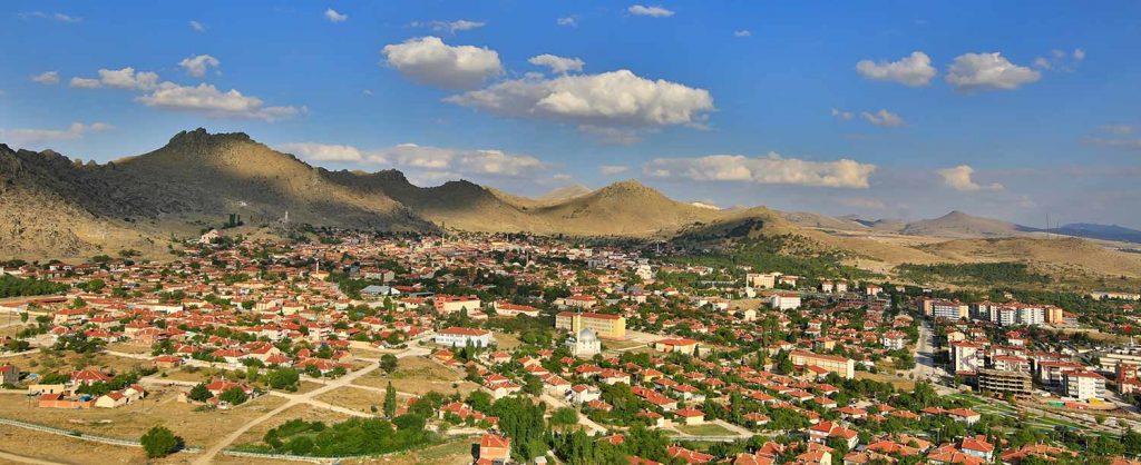
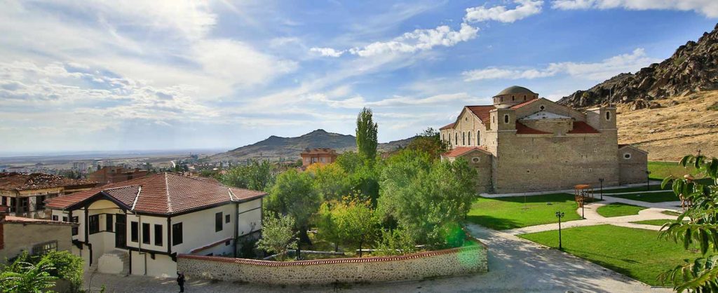
Before touching upon the history of Sivrihisar, let’s get to know Sivrihisar a little; Sivrihisar is the largest district of Eskişehir. The district center is located at the intersection of the Ankara, Eskişehir and İzmir highways. It stands out with its sharp cliffs rising towards the sky at the foot of a volcanic rock mass that is an extension of Çal Mountain. These cliffs gave the district its name. A painted rock painting was discovered by the Eskişehir Archaeological Museum Directorate in the Hisarönü-Balkayası location of the rocks. A scene consisting of horse, human and dog figures was painted on the rock surface with red paint.
Taking firm steps towards becoming a brand city in tourism, Sivrihisar is the largest district of Eskişehir. It stands out with its sharp cliffs rising towards the sky at the foot of a volcanic rock mass that is an extension of Çal Mountain. It is at the intersection of Ankara, İzmir and Eskişehir roads. It is 100 kilometers away from Eskişehir, 135 kilometers away from Ankara, 120 kilometers away from Afyonkarahisar, 448 kilometers away from İzmir, 427 kilometers away from İstanbul and 520 kilometers away from Çanakkale.
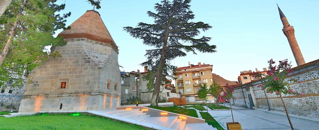
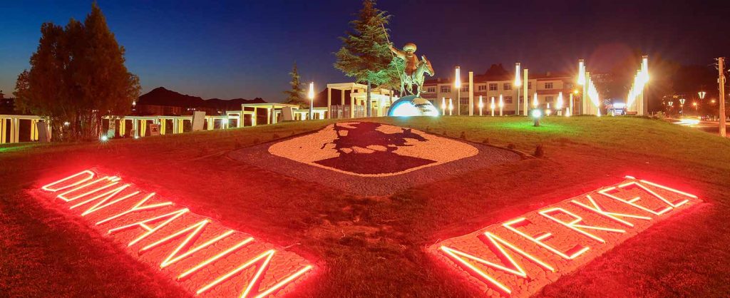
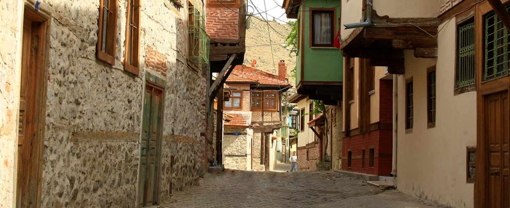
With its history, culture, nature and tourism, SİVRİHİSAR, which is the Center of the World as Nasreddin Hodja said, is an undiscovered tourism resort with its unique architectural texture, historical artifacts, important figures, cultural values, nature sports, natural and wildlife, flora and fauna including endemic species. Sivrihisar, which attracts the attention of visitors with its many heritages inherited from the Phrygians, Romans, Seljuks and Ottomans at the intersection of historical roads, Pessinuss, where the famous king's road passes and where the Cybele temple is located, Balıkdamı Bird Paradise where birds from three continents stay, the Armenian Church Surp Yerortuyun, the second largest church in Anatolia and especially the Ulu Mosque, one of the largest wooden-pillared mosques in Anatolia, will give the feeling that time has frozen in dozens of historical mosques, small mosques, fountains, baths and old neighborhoods.
Sivrihisar carries the characteristics of a rich culinary culture with its pearl earrings, pocket squares, five-chimney rugs and being a place visited by various civilizations for centuries.
Sivrihisar is the stop for those who set out on the road with the desire to discover, for travelers, for those in search of brand new tastes, for those who want to walk in the footsteps of history and for those who seek peace.

DISTRICT POPULATION: 2015 YILI 21.265 ERKEK 10.678 KADIN
DISTRICT AREA: 2.987 km²
Altitude: 856 m
Coordinates: K 39° 26’ 23’’ D 31° 31’ 48’’
General Information Country: Turkey
Geographical Area: İç Anadolu
City: Eskişehir
Post Code: 26600
Area Code: 0222
Plate: 26
IN THE DISTRICT 78 there is a neighborhood.
Altitude of the Center: 1.100m (3.609 ft)
The annual average temperature is 10-12 degrees.
The highest and lowest temperatures recorded are 39.1 °C and –26.3 °C.
Sivrihisar District is located in the northwest of the Central Anatolia Region. It borders the Black Sea to the north, the Marmara to the northwest, and the Aegean to the west and southwest.
Although most of the land has a plain appearance, high mountains and rocks here and there disrupt the plainness of the land. The most important elevations are the Sivrihisar Mountains. The highest of these mountains is Çal Mountain. Other important mountains and hills are Arayıt Mountain, Boztepe, Büvelik Hill and Yediler Hill. The main stream of our district is the Sakarya River.
-
5000-3000 BC Chalcolithic Age
This painting, dating back to the Chalcolithic Age, is important not only in the Sivrihisar region but also in terms of being the first and only example known in Central Anatolia. Archaeological research shows that the Sivrihisar region was densely populated during the Bronze Age. The region was also the main settlement area of the powerful Iron Age kingdom of the Phrygians. There are beautiful examples of Phrygian settlements and rock monuments on the rocky slopes of the Sivrihisar mountains. The city of Pessinus (Ballıhisar), founded by the Phrygian king Midas, is located here. The famous Persian King's Road of the period passes through Pessinus within the district borders.
-
1st century BC - 15th century AD Byzantine and Roman Empire Periods
It maintained its commercial and military importance during the Roman and Byzantine periods. The name of the castle and the settlement on its skirts in the northwest of the town center was Spaleia in this period. Sivrihisar came under Seljuk rule in 1074. During this period, a development campaign began in the town, which took the name Karahisar, and many structures such as mosques, madrasahs and baths were built. -
14TH CENTURY AND AFTER Anatolian Seljuk Empire After
After the collapse of the Anatolian Seljuk State in 1308, the region came under the control of the Ilkhanate, and when the influence of this state in Anatolia decreased, it remained within the borders of the Germiyanoğulları Principality, whose center was in Kütahya, one of the Turkmen principalities that declared their independence. During the reign of Sultan Murad I, it was a district connected to the central sanjak of the Ankara province. In 1915, it was connected to Eskişehir.
The district lands, which were occupied by the Greeks after World War I, were liberated from the occupation on September 20, 1921.
Source: https://sivrihisar.bel.tr/15-sivrihisar-tarihi.html

Click here to access the Sivrhisar travel guide.

Sivrihisar District Governorship web page: http://www.sivrihisar.gov.tr/ilcemiz


